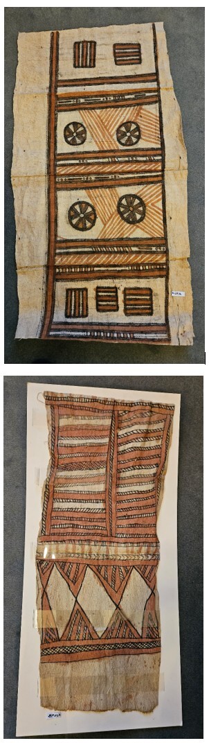
Tapa Cloth - two examples
The Tapa displayed symbolise historic journeys. These are basically navigation designs used in a similar way to navigation instruments and charts that were used by Captain Cook. The design is determined through the items that one would see on a sea journey. The circle shows the sun when overhead it was locally 'noon'. When the moon was overhead it was midnight. The cloth also shows 'rope' like figures, and determines weather patterns. When the tide is running hard, or the seas rough, the navigators of Samoa used ropes to keep their craft together, as they were bound by fibre. The triangle or diamonds indicate leaves. The leaves form patterns of current or tidal movement which may then be interpreted whilst at sea on the proximity of land, shoals or indeed current direction patterns. Polynesians were very good navigators, amazing early Europeans with their accuracy.
Source RGSSA R129
Special thanks to the Samoan Community in Samoa and South Australia for their interpretations of the Society's tapa cloths. The Society has not been able to locate any acquisition/accession records to date (April 2018) Information from Samoa by Losa Latulipe (Taupau) and Tekauita Latulipe. Taupou is Chief of the village. Taupau has consulted with the village elders to determine a possible source of the cloth in the Society collections. The elders are of the view the smaller one is from Samoa and the larger either Tonga or Hawaii.
Relics & Artefacts |