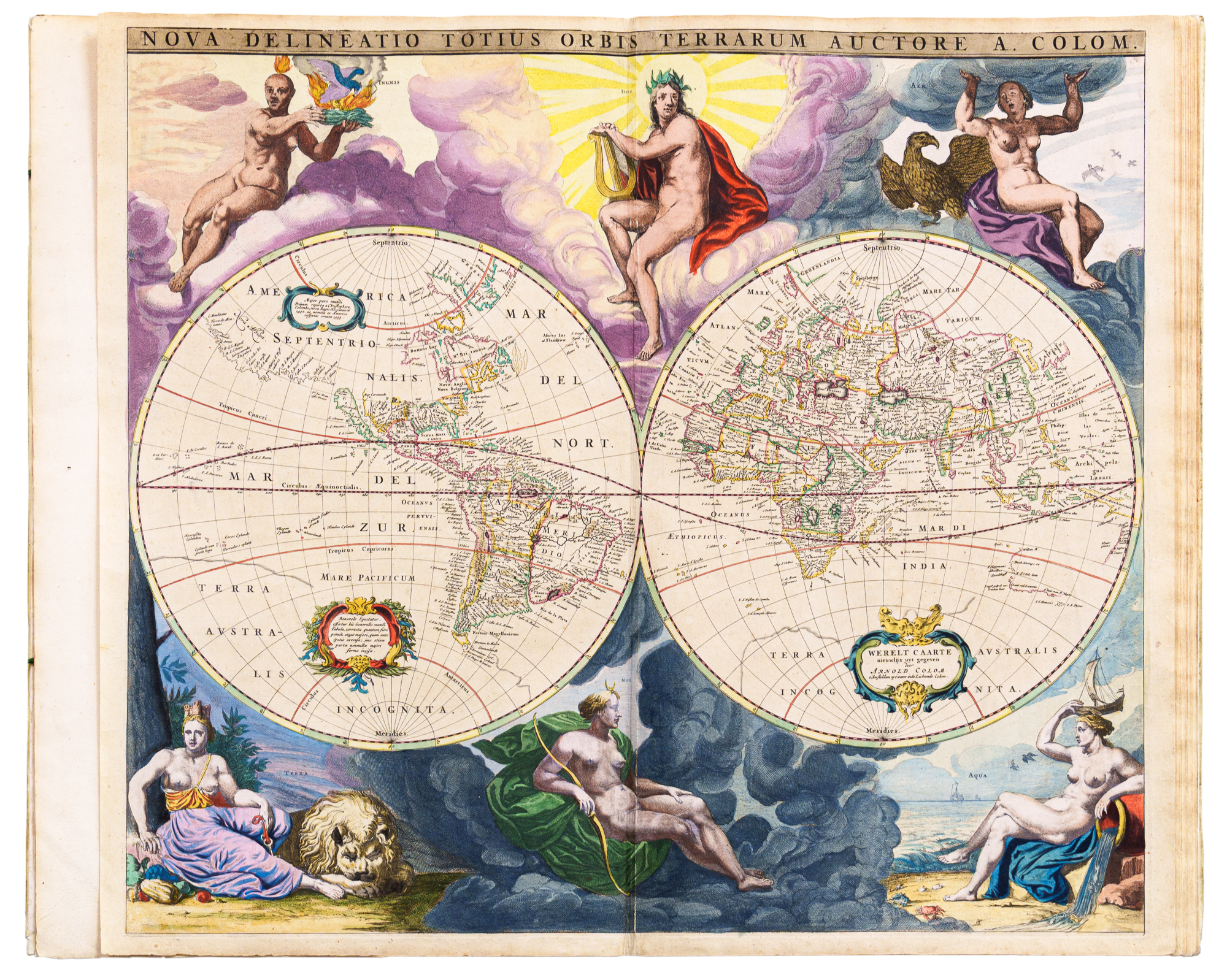
This rare atlas, mostly of charts, includes one of the earliest published maps showing part of the south coast of Australia. These charts are exceptionally beautiful with ornate cartouches and vivid colouring.
Colom - Zee-atlas, ofte water-wereldt. : In houdende een Korte beschryvinge van alle de bekende zee-Kusten des aardtrycks. Nieuwelijcks uyt-ghegheven 1658
(Colom - Sea atlas of the water world: containing a brief description of all known sea coasts of the earth. Newly published 1658*)
Marine charts began to be published in the latter part of the 16th century and are far rarer than land maps for which there was much greater demand. This is one of the many rare atlases from the Society’s collections.
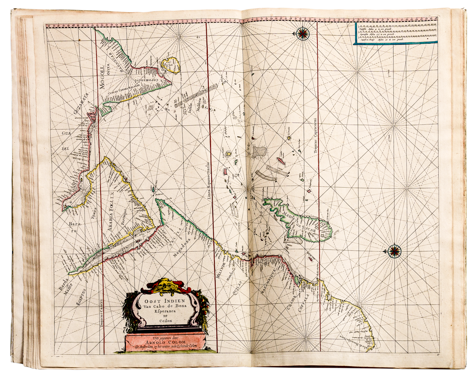
The discovery of the South Australian coast as far as the islands off what is now Ceduna was made in January 1627 in the ship Gulden Zeepaard of the Dutch East India Company (VOC). This was well before the voyages of Abel Tasman in 1642 and 1644. Eventually the western coast was mapped as well by cartographers such as Arnold Colom.
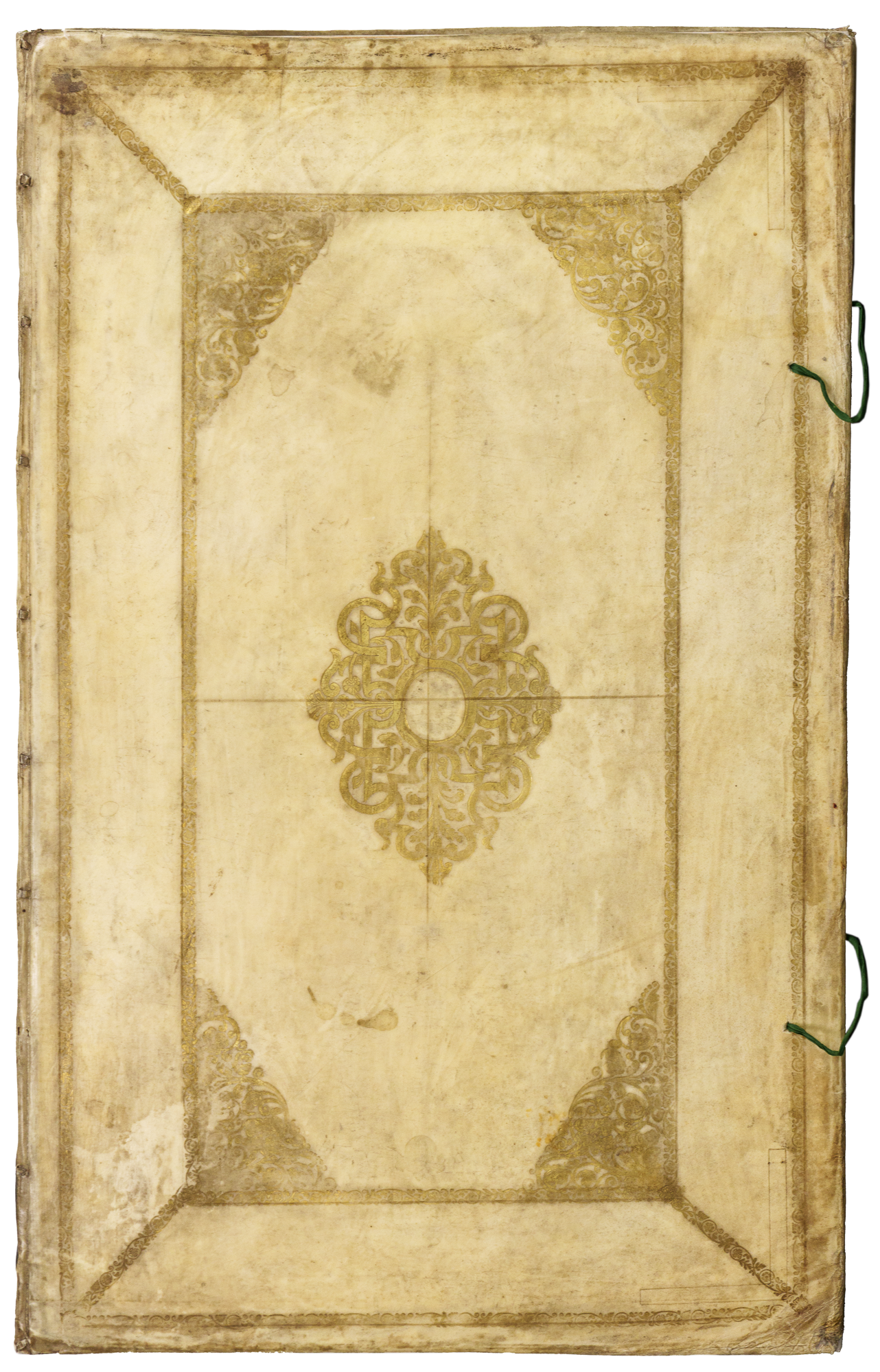
The decorative figurines used at this time have been attributed to Peter Paul Rubens or his disciples and were used by the Plantin publishing and printing House in Antwerp. This volume is bound in its original vellum covers and the maps open out to double size.
Arnold Colom and his father Jacob produced many fine atlases. A sea atlas provides little or no detail of the interior of countries but only the detail of the surrounding seas, with coasts, reefs, and islands mapped. The tracery of lines across the charts are rhumb lines and are navigation lines.
*With thanks to Ms Nynke van der Schaaf for this translation
RGS 912 C718 d rare book room
The following is a quotation from Tooley's Maps and Map - Makers -
"The Low Countries for roughly a century, from 1570 to 1670, produced in some respects the greatest map-makers of the world. The centres of production, at first in Antwerp and Duisberg, soon shifted to Amsterdam. For accuracy according to the knowledge of their time, magnificence of presentation and richness of decoration, the Dutch maps of this period have never been surpassed."
This Colom atlas, in the collection of the RGSSA, is a good example of the high point in Dutch map and chart publications referred to above.
The first European discovery of the South Australian coast was in January 1627. The ship 't Gulden Zeepaard of the Dutch East India Company (VOC), under the command of Frans Thyssen sailed from the Netherlands for Java on 22 May 1626. Quite why the ship subsequently sailed along the southern coast of Australia instead of turning north at Cape Leeuwin in Western Australia for Java is not known. The ship did however continue to sail east as far as the Islands of Saint Francis and Saint Peter (later called Nuyts Archipelago by Matthew Flinders), near Ceduna, before turning back and proceeding to Java.
It is only in maps of the time that this discovery of the southern coast of New Holland (Australia) appeared. Any reports of the voyage have been long since lost. The islands of Saint Peter and Saint Francis are believed to be named for the ship's captain Frans (Francis) Thysssen, and Pieter (Peter) Nuyts, a Dutch East India Company official travelling aboard the ship. The long stretch of southern coast appeared in maps and atlases usually marked 'Landt van P. Nuyts 26 January 1627'. Arnold Colom's map of the Oost Indien (East Indies) includes Dutch discoveries in Australia.
The islands in the Recherche Archipelago in Western Australia are also shown as well as several anchorages. The portions of the Western Australian west coast also discovered by the Dutch are shown, as is the west coast of Cape York Peninsula, discovered by Willem Jansz in 1606.
References
Tooley, R V Maps and Map-Makers, Crown, New York,1952
© The Royal Geographical Society of South Australia