Level 3 Mortlock Wing State Library of South Australia North Terrace Adelaide SA 5000

Historia Mundi: or Mercator’s Atlas – in English, published London, 1635

Gerardus Mercator (1512-1594) was a Flemish geographer, engraver and mathematician renowned for his production of maps, globes and scientific instruments. His Atlas, first published (posthumously) in 1595, represents the first appearance of the word ‘Atlas’ to reference a book of maps. 

Mercator Map 1

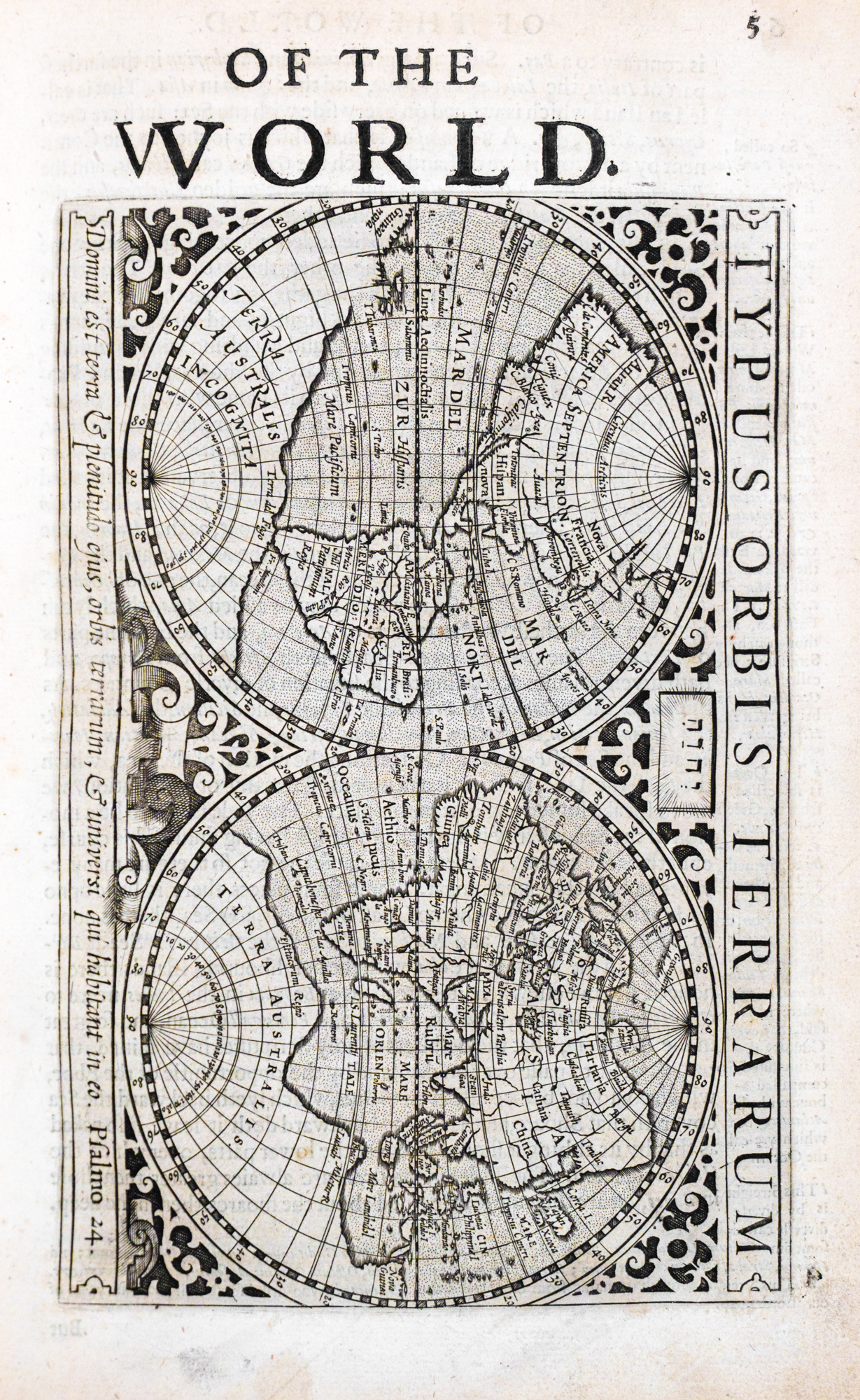
Gerardus Mercator (Latin form of Gerhard Kramer) was a Flemish geographer, engraver and mathematician renowned for his production of maps, globes and scientific instruments. Mercator is best known for his work in the field of cartography and his development of the cylindrical projection, now known as the Mercator projection, that allowed for straight lines of constant compass bearing to be represented as straight lines on the map, making it an invaluable tool for sailors and navigators. His most famous map: Nova et Aucta Orbis Terrae Descriptio ad Usum Navigantium Emendate Accommodata ('A new and more complete representation of the terrestrial globe properly adapted for use in navigation') was published in 1569. Mercator's early maps were in large formats suitable for wall mounting but in the second half of his life, he produced over 100 smaller regional maps suitable for binding into book format.

Mercator’s Atlas was first published posthumously by Mercator’s son Rumold in 1595. The first edition in 1595 and most subsequent editions of the Atlas included a decorative frontispiece engraving showing the mythological Atlas holding up the world. Mercator had envisioned an extensive work containing maps from modern and ancient geography and had published his Ptolemy maps in 1578, followed by maps of modern geography for parts of Europe in 1589. For the 1595 first edition of Mercator’s Atlas, Rumold included as much of his father’s posthumous cartography as possible, added his own world map and had cousins engrave maps of other continents. After Rumold’s death in 1599 the copperplates for the Atlas were sold and came into the hands of Jodocus Hondius (Latin form of Joost de Hondt), whose family continued to republish and update the Atlas, releasing over 50 editions in the main European languages.

Rgsp 910 M553 b 1635

The Mercator’s Atlas in the collection of the Royal Geographic Society of South Australia was acquired with the York Gate Library in 1905. It was published in English in 1635 with the title page inscribed:

   HISTORIA MUNDI: OR MERCATOR'S ATLAS.
   Containing his COSMOGRAPHICALL
   Description of the Fabricke and Figure of the WORLD.
   Lately rectified in divers places, as also beautified
   and enlarged with new Mappes and Tables;
   By the studious industry of IVDOCVS HONDY
   ENGLISHED BY W.S. Generosus, & Coll. Regin. Oxonia.
   LONDON

      Printed by T. Cotes, for Michael Sparke and Samuel Cartwright, 1635

The maps in the Mercator’s Atlases were frequently updated for new editions to reflect new geographical knowledge of the world. In 1635 the continent of Australia had not been mapped and so does not appear in this edition. Instead, a speculative coastline has been drawn for a large southern landmass labelled Terra Australis Incognita. The Atlas text refers to the “islands scattered up and down the Indian and Easterne Sea …. with Nova Guinea lastly found out; concerning which it is not yet known whether it be an Island or joined to the Southern Continent.”

A scanned version of a similar edition to this Atlas is available on Trove at https://nla.gov.au/nla.obj-692149845/

The scanned Atlas on Trove contains a frontispiece image of Atlas holding the world on his shoulders – this frontispiece is missing from the RGSSA Atlas.

Mercator Atlas
Mercator Atlas