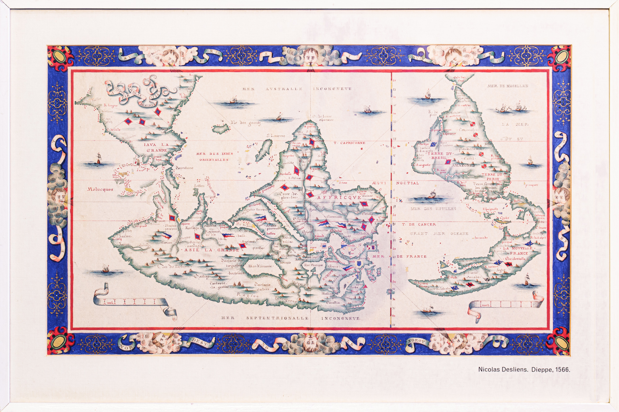
This map was drawn with south at the top which was not uncommon until the use of the magnetic compasses became widespread. It is an excellent hand drawn copy from 1884 of one of the world’s oldest maps.
Medieval church maps were usually oriented with the east at the top of the sheet and there was no consistent convention of the north at the top until the use of the magnetic compass became widespread. In this 'Mappemonde’ (i.e., map of the known world), south is at the top of the drawing. It is part of a series known as The Dieppe Map School. This is a hand-drawn copy of the original held in the Bibliothéque Nationale in Paris, made by Henri Delachaux in 1884. Notes on its provenance are with the item.
This map was acquired in 1905 through the York Gate acquisition .
On the back is a type written note by Augustus Petherick, the York Gate Librarian 1905 giving more details of its acquisition and provenance - this is reproduced here, together with a memo by the compiler of the York Gate Catalogue.
Wall map 100a 1566-in the drawer of the Benham Bookcase
© The Royal Geographical Society of South Australia