Level 3 Mortlock Wing State Library of South Australia North Terrace Adelaide SA 5000

Nixon's map of Adelaide 1838

This very early map of Adelaide dated 1838 was drawn by Lieut. Henry Nixon who was a member of Colonel Light's survey party. It shows interesting detail of Adelaide in its very early days.

Nixon Adelaide District Plan Map

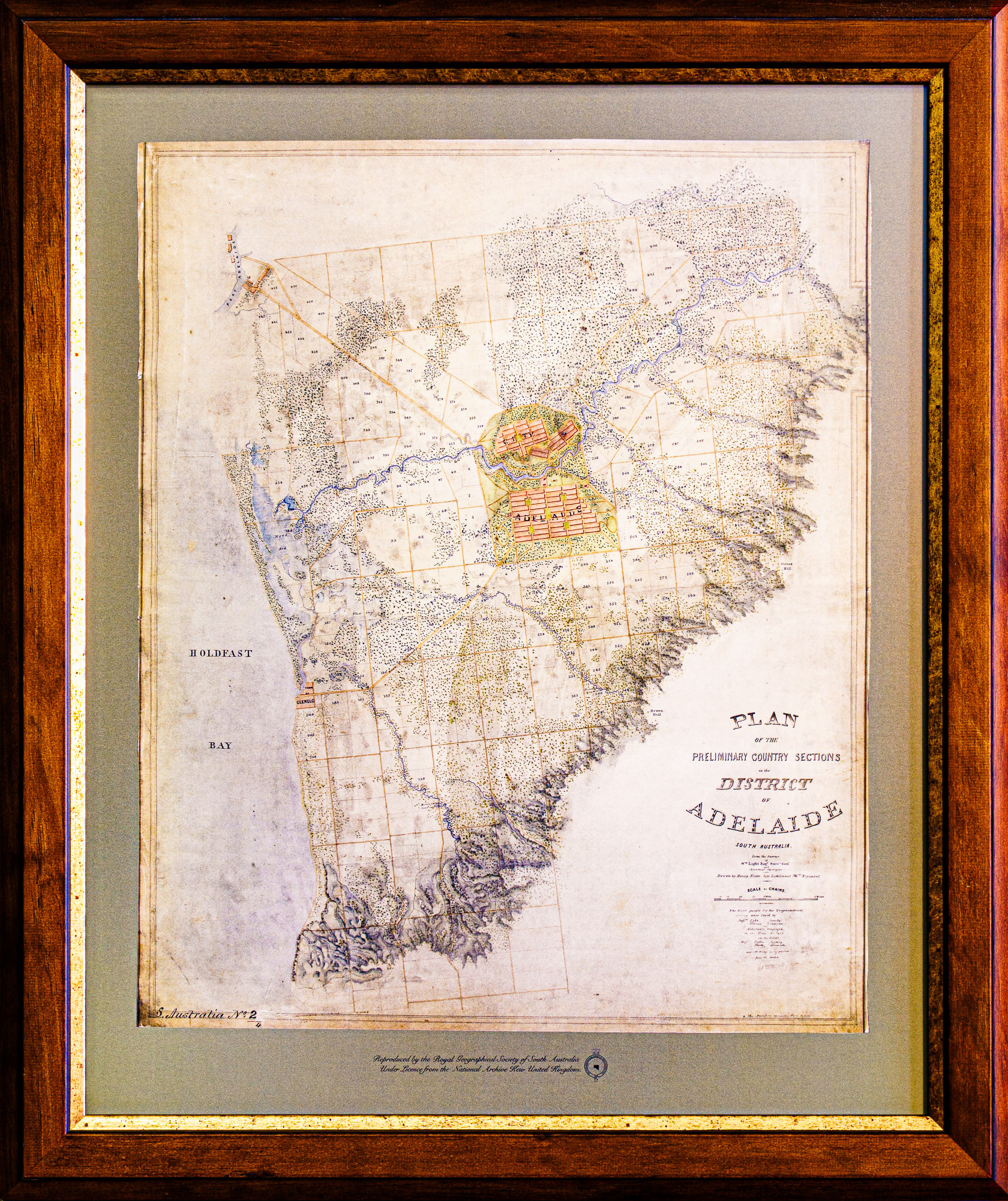
At the time this map was drawn Col. William Light had already selected the site for the City Adelaide and designed its layout but the detailed survey of the street and allotments was on going.

This map, drawn by Nixon in 1838 from information about the Preliminary Country Surveys undertaken by Light, shows the almost Elysian appearance of the Adelaide Plains, with creeks and the river delineated with vegetation. It also shows the terrain over which the Europeans had their first encounters with the Aboriginal people and the effect of thousands of years of indigenous occupation of what became known to the Europeans as the Adelaide Plains.

This view of the Adelaide Plains also demonstrates part of the logic behind Light’s choice of the site of Adelaide, with the city surrounded by sustaining rural sections and a safe harbour within reasonable proximity.

(The original of this map is located in the National Archive Office, London).


-Rg 910.6. The map can be seen hanging on the wall of the RGSSA Library.  Copies are available for sale.

Lieutenant Henry Nixon arrived in the Province of South Australia on the Navarino in December 1837, after a career in the British Army, having served in Ireland, Nova Scotia and Scotland. In South Australia he was appointed an assistant in the survey team of the Surveyor-General, Colonel William Light.

On 2nd July 1838 most of Light’s survey team resigned in support of Light after a stand-off with the Colonization Commissioners for South Australia who thought that the surveys were proceeding too slowly. There was a huge unmet demand for surveys which was affecting land sales, and Light was refusing to adopt a ‘running survey’ as the Commissioners had suggested. George Kingston continued surveying with the remainder of Light’s original team, which included Henry Nixon, while Light, Boyle, Travers, Finniss and others formed a company to undertake survey work privately.

In July 1838 Nixon resigned from George Kingston’s survey team complaining that he was treated as a slave. He joined Light and Finniss and in early 1839 also went into partnership with William O’Halloran as a land agent. Henry Nixon named the Village of Marion on the Sturt River and there is a street in Marion named after him. He died in 1843 and is buried in West Terrace Cemetery.