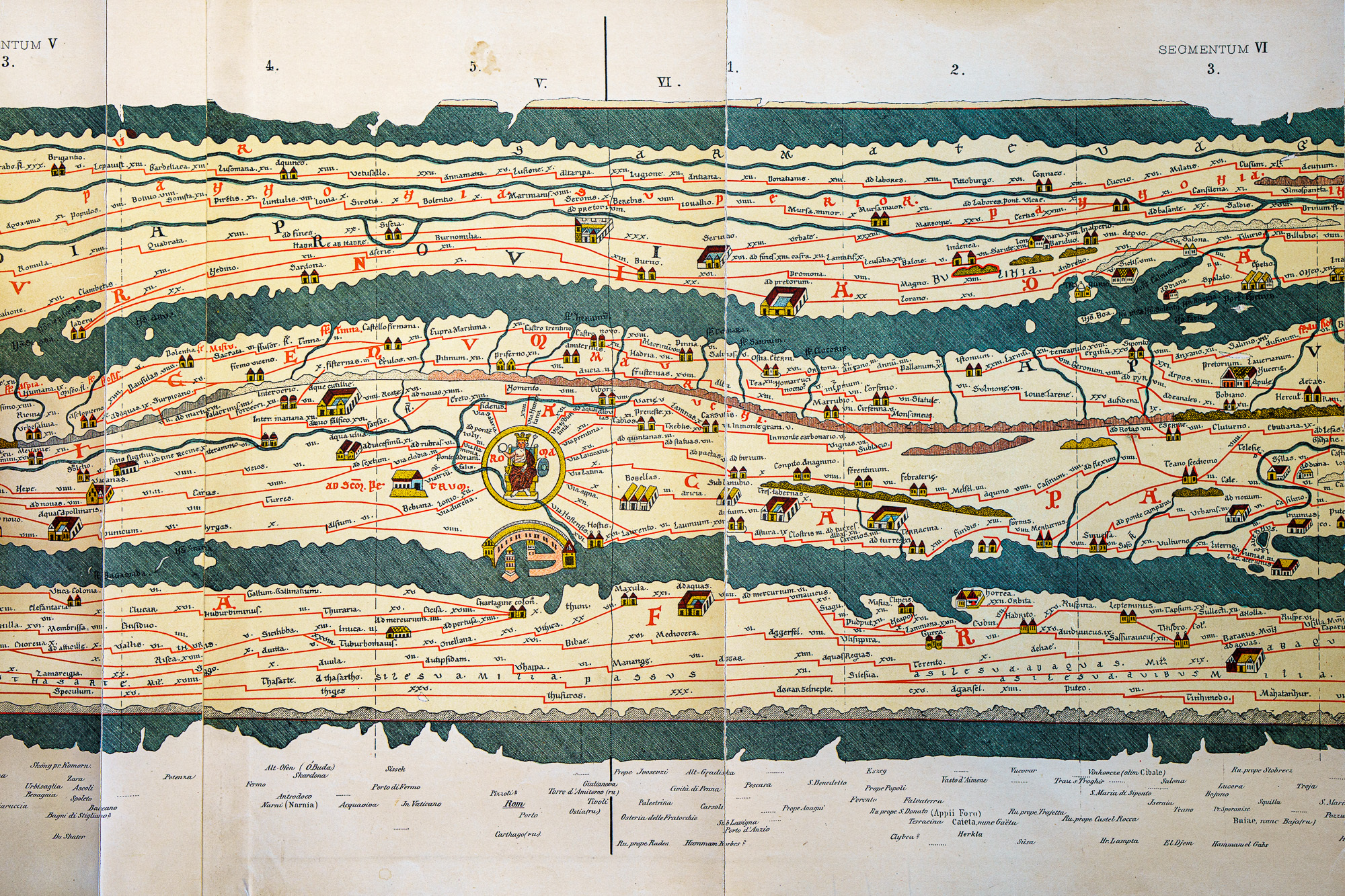
Maps of routes for specific purposes - military or trade - were produced by the Romans and revised, corrected and added to for the next 500 years. The Peutiger Table has no overall orientation and no consistent scale, resembling in this the 'strip maps' issued for specific journeys by the Royal Automobile Association.
Drawn in 1265 by a monk from Colmar - and now kept in the Austrian National Library - it is a medieval interpretation of the original Roman scroll which is no longer thought to exist. It is made up of 11 parchments scrolls and measures approximately 34 cm high by 6.74 m long when assembled. This document was discovered in 1494 by Konrad Meissel, alias Celtes, and given in 1507 to the Antiquarian of Augsburg, Konrad Peutinger, a Hapsburg court official. First printed in Antwerp in 1598 through the Plantin press and copied in the 19th century.
The oldest information on the map probably goes back to before 79 AD since Pompeii is indicated. Other temporal indications can be drawn from Jerusalem, which is named Aelia Capitolina, the name given in 132 AD, and from Constantinople (now Istanbul) the name being commonly used since the 5th century for Byzantium.
As expected all roads lead to Rome and the city is depicted at the centre of the 7m long scroll. The distances are in Roman Miles, which are 1,000 paces.
Map making (cartography) was usually done by taking prior copies, adding new knowledge, and then striking a new copy. Errors often crept into the maps, however this map is remarkably accurate for its time.
Located in the RGSSA Library, Mortlock Wing, the Peutinger strip map may be seen during opening hours.