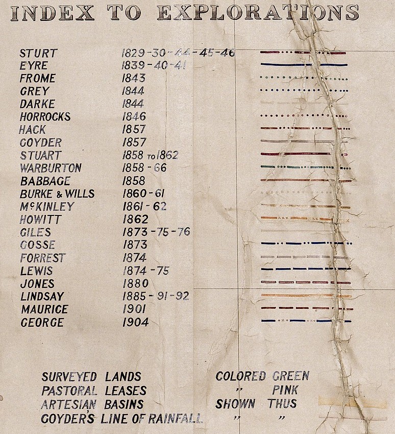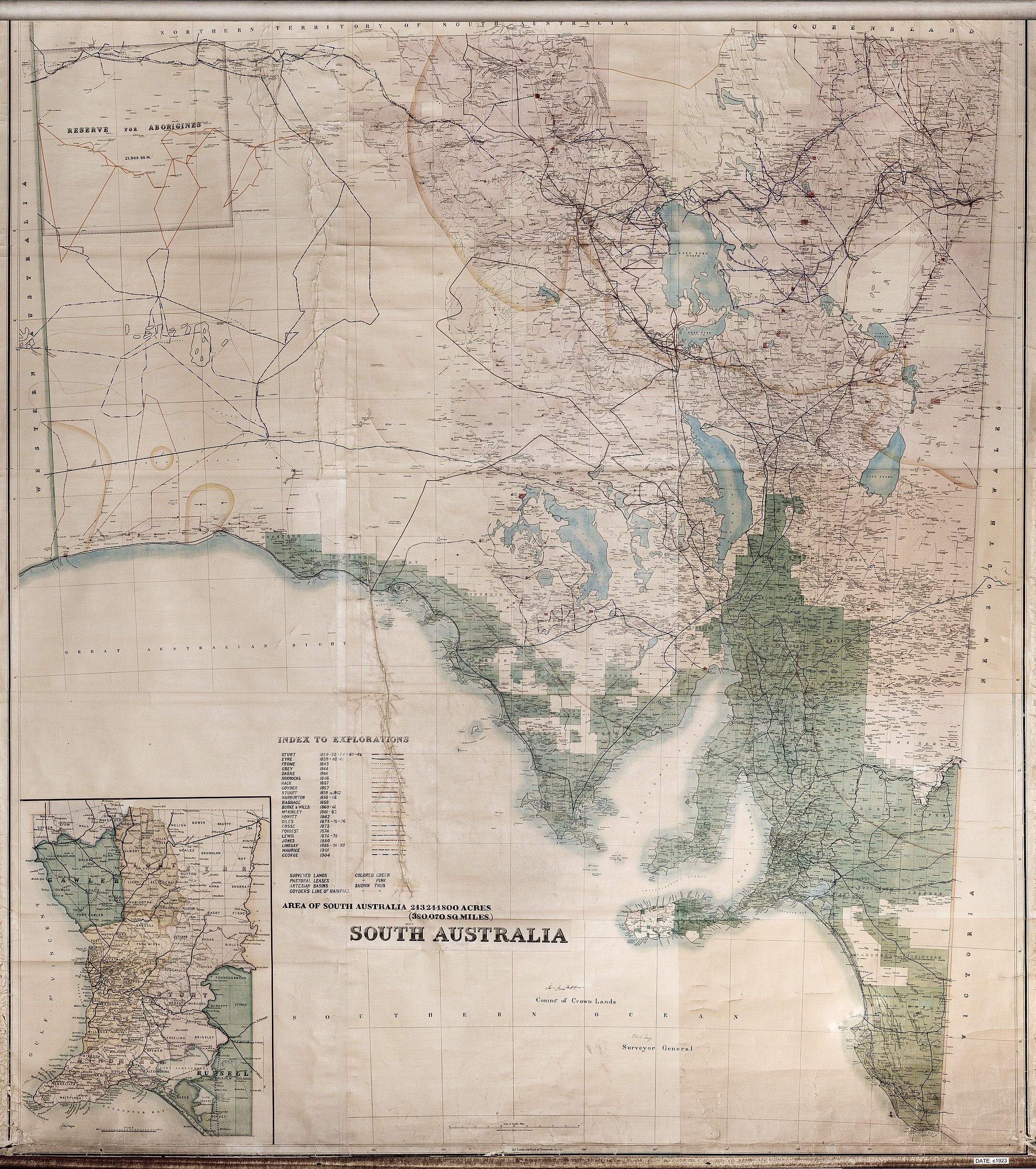
References to this magnificent map and it's provenance have been reported in the Society's journal;
- "We specially mention the Surveyor-General's Department, who have mounted the large-scale map of the State which was prepared by them last year, showing the route taken by the various explorers from 1829 to 1904, etc. This map has now been hung on a Board in the Library specially constructed for the Society." (The Proceeding Volume XXV 1923-24)
- "Your Vice-President, the Surveyor-General, Mr. C. M. Hambidge, has undertaken the correction of the explorer's routes as marked on the big map hanging in our Library." (The Proceedings Volume LXIV 1942-43)
- The map seems to have been used by the Surveyor General for a lecture to Society members viz: II-Principal Land Utilisation in South Australia (with coloured map )-C. M. HAMBIDGE pp9-pp25 lecture (The Proceedings Volume LXVII 1945-46) "I have divided the State into some major divisions, varying in size from the extensive unoccupied and purely grazing areas to the comparatively small horticultural areas, as under: -
- Unoccupied country.
- Pastoral country, cattle.
- Pastoral country, sheep.
- Marginal lands.
- Agricultural lands.
- Grazing with some agriculture, limestone country.
- Dairying and intense grazing.
- Undeveloped, light grazing.
- Horticulture.
In addition, the Main Government Forest Areas are shown and some of the reserved areas. "